Port of Narsarsuaq, Greenland | Cruise Port Guide

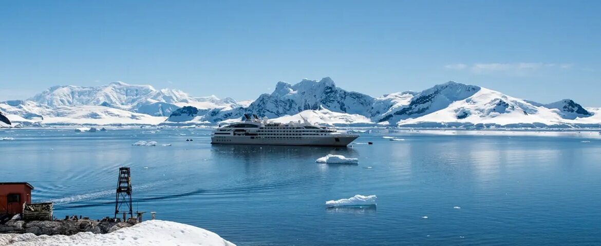
A runway in the middle of the fjords: that, first and foremost, is what Narsarsuaq is. In 1941, the U.S. Army chose this strip of land in southern Greenland to build the Bluie West One air base, a link in the transatlantic connections of the Second World War. Thousands of aircraft stopped here. Today, the hamlet's hundred or so residents live around the airport inherited from that era — and welcome the ships that anchor in Tunulliarfik Fjord.

A hamlet born of a war

The museum near the runway tells this singular story: photographs, uniforms, navigation instruments and accounts from the crews who crossed the Atlantic in stages. You come to understand why this remote corner of Greenland was, for a few years, one of the busiest airfields in the Arctic world. Around it, a few hangars and period buildings complete the scene.

The Valley of Flowers, a path to the ice

Behind the hamlet opens the Valley of Flowers, carpeted in summer with fireweed, harebells and dwarf willows. The trail climbs the valley floor to a lookout facing the Kiattuut Glacier, a tongue of the ice sheet that descends between the ridges. Allow three to four hours round trip, on sometimes rocky ground: the effort is rewarded with a rare view of the ice cap at eye level. It is one of the most accessible walks in the country to the great ice.

An arboretum in a treeless land

Another surprise: since 1988, Narsarsuaq has been home to an arboretum where about a hundred species from the world's subarctic and alpine zones grow. Siberian larches, Alaska spruces and mountain pines test their resistance to the Greenlandic climate. The trail that climbs toward Signal Hill crosses these plantings and opens onto a sweeping panorama: the fjord, the runway and the icebergs waiting in the bay.

Brattahlid, Erik the Red's farm

Opposite, on the other side of the fjord, a ten-minute boat ride leads to the village of Qassiarsuk, the Brattahlid of the sagas. It was here that Erik the Red, banished from Iceland, founded the first Norse settlement in Greenland around 985. A turf longhouse and a wooden chapel have been reconstructed near the original remains, within a farming landscape inscribed on the UNESCO World Heritage List as Kujataa. Between the sheep and the ruins, a thousand years of history fit in a pasture.

The ice of the Qooroq

Another popular outing: a boat trip up the ice-filled Qooroq Fjord, where a front of the ice sheet spills its blocks into milky water. The boats weave between the drifting pieces as far as the density of the ice allows, engines idling, in a silence broken by cracking sounds. The contrast with the pastures of Qassiarsuk, barely a few kilometres away, sums up all of southern Greenland: ice and grass, side by side.

Gearing up for the day

Good shoes, a windbreaker, a water bottle and sun protection: basic gear is enough to enjoy the trails. The terrain is open and the distances reasonable, but loose stones and wet stretches call for a minimum of care. Guided excursions generally provide what is needed, including for the approach to the glacier front.

Port call pointers

ItemPointer
Disembarkationsmall pier or tender depending on the ship
Bluie West One Museumnear the runway, within walking distance
Valley of Flowers (glacier lookout)3 to 4 h walk round trip
Qassiarsuk / Brattahlidshort boat crossing

Taking off, setting sail

Here, everyone eventually leaves: the planes of yesterday, the ships of today. What remains is what does not move — the ice at the end of the valley, Erik the Red's stones across the water, and the paradox of a wartime airfield turned gateway to one of the most peaceful landscapes in the Arctic.

Frequently Asked Questions

Ships anchor in Tunuliarfik fjord and land passengers by tender. The settlement sits around its airstrip, a few minutes' walk from the landing.
Because the US military built Bluie West One here in 1941 as a link in wartime transatlantic air routes. Thousands of aircraft staged through, and the runway is still in use.
The museum near the runway, which tells the base's story through photographs, uniforms, navigation instruments and crew accounts. A few period hangars and buildings round out the setting.
A valley carpeted in summer with fireweed, harebells and dwarf willow, whose trail climbs to a viewpoint facing the Kiattuut glacier. Allow three to four hours return over ground that turns rocky in places.
Yes. The Valley of Flowers trail opens onto a rare view of the Kiattuut glacier, a tongue of the inland ice descending between the ridges. It is one of the country's most accessible walks toward the great ice.
Yes, at Narsarsuaq since 1988: about a hundred species from subarctic and alpine regions worldwide — Siberian larch, Alaskan spruce, mountain pine. The trail to Signal Hill runs through it.
By boat: ten minutes across the fjord to Qassiarsuk. This is where Erik the Red founded Greenland's first Norse colony around 985; a turf longhouse and a wooden chapel have been reconstructed there.
A popular boat excursion from Narsarsuaq: a front of the inland ice discharges into milky water there. Boats thread between the drifting blocks as far as the ice allows, engines at idle.
Good shoes, a windproof shell, a water bottle and sun protection will do. The terrain is open and the distances reasonable, but loose stones and wet sections call for attention.
A hamlet of about a hundred people arranged around the airport inherited from the war. You do not come for village life but for what surrounds it: the ice, the trails and the Viking ruins across the water.